
Two agile pilots will provide new information of urban plant life in Sompasaari while also engaging residents to take interest in the natural environment and its effects. The pilots are carried out by xD Visuals and Granlund as part of the B.Green project.
Plant life is the backbone of urban greenery but cities still have a low resolution of information about existing plant life in the urban setting. The goal of the Green Urban Mapping piloting is to explore and test new digital tools and participatory elements for collecting and managing natural environment data from new residential areas.
With the open call, B.Green seeked new solutions that easily allow tagging individual plants or areas of certain plant species into a geographic coordinate system. The solutions should also allow transferring the collected data into common CAD, GIS or BIM formats.
Altogether seven offers were received in the Open Call. Two pilots were selected to be carried out in Helsinki’s smart district Kalasatama in the upcoming months.
xD Visuals develops a Digital Twin for Vegetation by using survey data, city models and 3D data. The solution will visualise and map urban vegetation locations, dimensions and define species more accurately with parametric information. The solution complements the Helsinki digital twin with more detailed information of existing and planned urban vegetation elements.
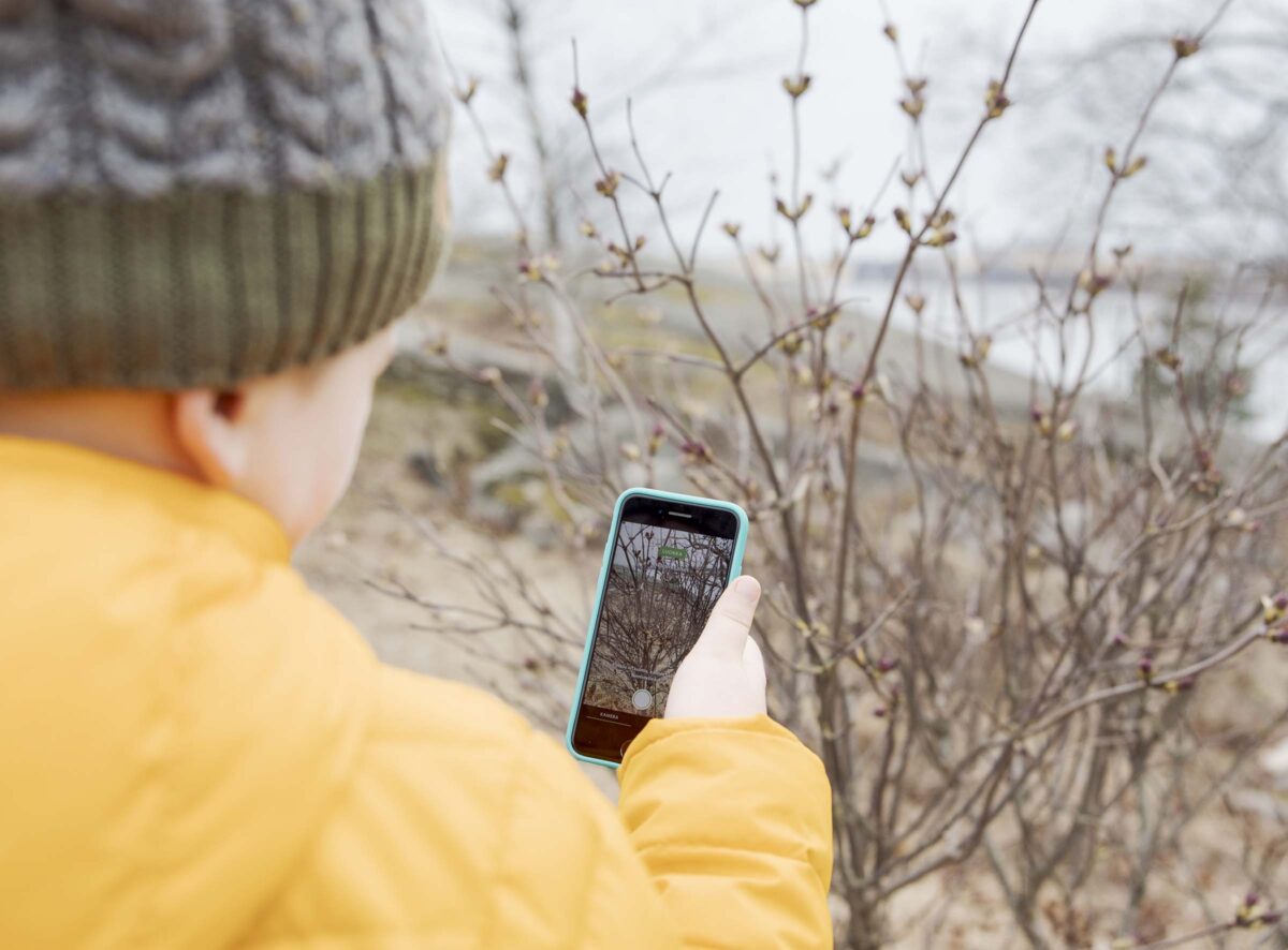
Granlund pilots PlantLIFE Mapper AR application that lets users accurately map local plants with the help of augmented reality technology. By using the application with their mobile devices, users can easily place plants from real life into a virtual environment. Users can also adjust the plants’ stage of growth and view different plants on a map in their surrounding area.
Green Urban Mapping in Sompasaari
Sompasaari, a sub-area of Kalasatama, serves as the pilot site for the two experiments. Local residents and urban planners will be actively engaged in the development process during the piloting. Residents will be invited to collect plant life data in their own living environment in January 2022.
Green Urban Mapping pilots aim to provide up-to-date information about existing plant life and the possibility to follow changes within the variety of plants in Sompasaari, while also engaging residents to take interest in the natural environment and its effect on their neighbourhood. Collected data will be analysed and learnings from the pilots will be utilised to support the decision-making of urban planners when planning new climate-resilient neighbourhoods and green spaces.
B.Green project aims at finding new, innovative tools and approaches to green infrastructure planning in urban areas together with the City of Helsinki, City of Tallinn and Stockholm Environment Institute Tallinn Centre. Agile pilots carried out as a part of the project contribute to the development of more ecologically sustainable urban planning in Helsinki and the Central Baltic area.
Additional information

Silja Peltonen
Project Portfolio Manager, EIT Digital
+358 40 742 6360
silja.peltonen@forumvirium.fi