A rapidly developing area under construction can be survey quickly and flexibly in almost real time through photogrammetric measurements. With materials surveyed with the help of a drone, planning an ever-changing area and monitoring its long-term development become easier.
In December 2021, Forum Virium Helsinki ordered a photogrammetric 3D model of the Postipuisto area in the district of Pohjois-Pasila, Helsinki, from Tietoa Finland Oy. The 23-hectare area, formerly a train depot, is constantly developing and changing, as homes for about 5,000 residents are being built there. At the same time, the area is already an everyday environment and home to the first of its residents.
A new residential area is in constant flux. The placement of traffic arrangements, such as streets, pedestrian paths and signs, may change at short notice, which may cause trouble for local logistics and residents. Map applications do not always stay on top of things, and urban information models are updated relatively rarely. This means that an up-to-date picture of the developing area is unavailable.
“Drone photography is a flexible and quick way of getting an accurate overview of the desired district,” says Juho-Pekka Virtanen, product owner of the urban digital twin at Forum Virium Helsinki.
The photography project showed how quickly it is possible to get an up-to-date visualisation of an area.
In rapidly changing and developing areas, receiving current information is especially important to the residents. Their needs should also be answered even while the area as a whole is still being constructed.
In the future, photogrammetric surveys could be used more extensively in Helsinki, e.g. for the development of the Helsinki Innovation Districts.
Accurate point clouds through low-altitude aerial photography
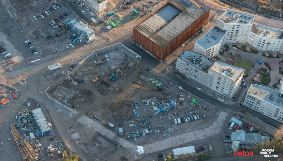
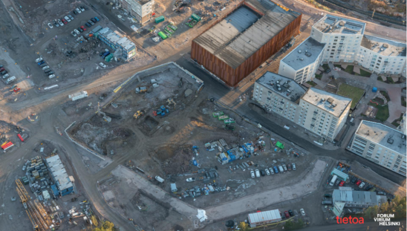
The Postipuisto area in Pohjois-Pasila was surveyed photogrammetrically using a drone. In photogrammetric surveys, a drone photographs the target area from multiple directions. The materials consisting of thousands of digital aerial photographs are compiled into a 3D model where you can view each target three-dimensionally from any direction. You can see the targets’ exact location on the map when control points with known locations are pointed out from both the map and the ground. These types of drone surveys are becoming increasingly established, which makes it easier to use them for various applications.
The flights for oblique aerial photography were carried out at a height of 70–80 metres. Through low-altitude aerial photography, an accurate point cloud was achieved in colour, from which you can easily detect street surfaces and markings. The flights took place at the end of the year, which affected the photography as daylight hours are very brief at this time of the year. However, the survey was completed successfully on an exceptionally light and snowless day in December.
“The survey results were aligned with the City’s coordinate system with the help of control points on the ground. This allows the photographed area to be combined with location data and urban model materials and also facilitates follow-up monitoring in the ever-developing area,” says Jaakko Hauru, Unit Manager from Tietoa.
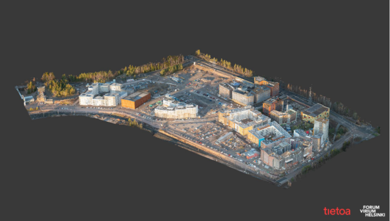 Photo by: Tietoa Finland Oyj and FVH
Urban digital twin progresses step by step
The photogrammetric model lays the foundation on which you can present various plans and materials over an up-to-date view. You can even complement the model with 3D models of new buildings being planned or maps of upcoming traffic arrangements. You can also use regularly performed surveys to make a time series which allows you to study the area’s development.
The materials based on drone mapping also support the development of Helsinki’s digital twin. The materials obtained can be used for various projects and applications moving forward. At the moment, the materials are being used to develop accessibility data for logistics, the Smart City projects, and the LIDO initiative compiling traffic and mobility data.
Additional information

Juho-Pekka Virtanen
Technical Specialist
+358 40 635 1212
juho-pekka.virtanen@forumvirium.fi

Pyry Tamminen
Technical Specialist
+358 45 886 6288
pyry.tamminen@forumvirium.fi